The Sky Islands


An Archipelago in a Cordilleran Gap – The Sky Islands of Arizona and Sonora
Excerpted, in part, from Brusca & Moore, “A Natural History of the Santa Catalina Mountains, with and Introduction to the Madrean Sky Islands,” Arizona-Sonora Desert Museum Press, 2013
All text and images on this page copyright R. Brusca and W. Moore
The outcome of millions of years of mountain building, the 4500-mile-long (7250 km) North American Cordillera (or “Western Cordillera”) runs from northern Alaska to southern Mexico—about the same length as the Andes Mountains. This great cordillera, sometimes called the spine of the North American continent, has but one break, a low saddle called the Cordilleran Gap between the Rocky Mountains/Colorado Plateau and the Sierra Madre Occidental of Mexico. This low-elevation gap is a biogeographic barrier between the high-elevation, temperate and tropical montane biotas of the cordillera. About 65 isolated mountain ranges span the cordilleran gap, rising like islands from a sea of desert and grassland around them.
A mountain range in this region is defined as a Sky Island if it is high enough to rise above the valley floors of desertscrub or desert grassland. Should they rise above those communities, they will host oak habitats, and if they rise high enough they will also have pine forests and even mixed conifer forests with firs and spruces (a subalpine plant community). To qualify as a “Sky Island,” these woodlands and forests must be isolated, that is, they cannot be connected by woodlands (or higher habitats) to the Cordilleran ranges of the Rocky Mountains/Colorado Plateau or the Sierra Madre Occidental. Thirty-two Sky Islands occur north of the U.S.-Mexico border (see map). Because of the strong affinity of their woodland flora to that of the Sierra Madre Occidental, they are often called “Madrean” Sky Islands. But, at higher elevations their affinity lies to the north, to the flora of the Rocky Mountains and Colorado Plateau, so some might prefer to call them “Petran Sky Islands,” or simply “Cordilleran Sky Islands.”
The northernmost boundary of the Madrean Sky Islands is the long finger of Sonoran Desert that extends east from Phoenix along the Salt River Valley; north of this lie the Mazatzal and Bradshaw Mountains and other ranges in Arizona’s Transition Zone, which climbs in elevation to the base of the Mogollon Rim, the escarpment of the Colorado Plateau. The southernmost limit of the Sky Islands is somewhat arbitrarily set at 29° N latitude (about the latitude of Hermosillo, Sonora). Thus, the northernmost Sky Islands are the Pinals and Superstitions; the westernmost Sky Islands are Sierra el Humo (in Sonora) and the Baboquivari Mountains (in Arizona); the easternmost are the Alamo Hueco and Big Hatchet Mountains (in New Mexico); and the southernmost is the Sierra Mazatán (70 km east of Hermosillo, Sonora).
The Sky Island Region covers about 45,000 sq mi (~25,000 sq mi in the United States) and represents an overlap and blending of several major biogeographic zones. It is the meeting place of two great deserts, the Chihuahuan and the Sonoran, and two large mountain chains, the Rocky Mountains and the Sierra Madre Occidental. Thus, these mountain islands form biological “stepping-stones” (pathways for plants and animals to disperse over time) that connect the Rockies and Colorado Plateau with the Sierra Madre of Mexico. In Sonora and southernmost Arizona, the Sky Islands have a strong Madrean component (i.e., species from the Sierra Madre Occidental of Mexico) evident in the plant and animal species that have “island hopped” northwestward from the Sierra Madre Occidental. These southern species gradually diminish northward (and at higher elevations), where they are replaced by temperate species from the Rocky Mountains and Colorado Plateau. The most widespread pine communities in the Sky Islands north of the U.S.-Mexico border consist primarily of Rocky Mountain tree species (in contrast to Madrean species) and these are known as Petran Montane Forests. The elevation of these cold-temperate, Rocky Mountain (Petran) conifers increases on Sky Islands southward into Mexico until they are pushed off the tops of the mountains by excessive aridity and/or warmth and are completely replaced by Madrean conifers. The southernmost Sky Islands in the United States (e.g. Baboquivaris, Chiricahuas) support a mix of Petran and Madrean conifers. In the Chiricahua Mountains, for example, higher (and cooler/north-facing) slopes support typical Rocky Mountain species such as ponderosa pine, blue and Englemann spruce, white fir, Rocky Mountain maple, and Douglas-fir; lower (and warmer/south-facing) slopes support Madrean species such as Apache pine, Chihuahua pine, southwestern white pine, and Arizona pine. The northernmost Sky Island ranges (the Pinal and Superstition Mountains) largely lack common Madrean species, such as the silverleaf oak that is so common in the Catalina Mountains, and instead harbor abundant woodlands of northern species such as Gambel oak (the only winter-deciduous oak in the Sky Island Region), canyon live oak, and Petran coniferous forests at their higher elevations. The Pinals, which exceed 7800 ft elevation, contain a large pine forest, surrounded by well-developed oak woodland that connects to the woodlands of the Superstitions, the latter having only a few patches of ponderosa pine.
To visit Dr. Wendy Moore’s ASAP (Arizona Sky Island Arthropod Project) page: www.moorearthropods.com
What Are Sky Islands?
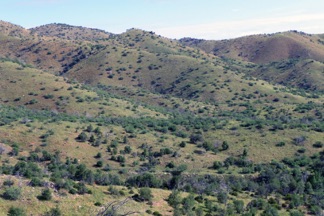
Two views of the Santa Catalina Mountains
How Diverse is the Sky Island Region?

The stepping-stone nature of the Madrean Sky Islands is apparent not only in the flora, but also in the fauna, and many temperate species have their range end-points in this region or just south of it in the northernmost Sierra Madre Occidental. For example, the southern range boundary for beaver (Castor canadensis) and bald eagle (Haliaeetus leucocephalus) is in the great Yaqui River basin of the Sierra Madre. In turn, many plant and animal species of the Sierra Madre Occidental extend their ranges northward across the border into the United States by island hopping on the Sky Island ranges. This mixing of northern and southern species creates an exceptionally high biodiversity in the region. Nearly 500 bird species have been reported from southeastern Arizona alone, more than can be found in any other similar-sized land-bounded area in the country, in large part due to the strong Mexican element seen in Arizona’s Sky Islands. This represents half the bird species in all of North America (957). In fact, over half of the bird species in North America, including Greenland, are found in the Chiricahua Mountains alone. Rare tropical pine-oak specialists such as the elegant trogon (Trogon elegans), Mexican spotted owl (Strix occidentalis mexicanus), and Arizona woodpecker (Piciodes arizonae) draw thousands of bird watchers to southeastern Arizona annually. The ~120 species of amphibians and reptiles in the Arizona portion of the Sky Island Region represent 80 percent of the state’s herpetofauna, and about 50 species of these are snakes, which is more than a third of all the snake species in the United States. Many of these Sky Island “herps” (e.g., brown vine snake, Ocybelis aenus; Sonoran shovel-nosed snake, Chionactis palarostris) are the northernmost outpost of tropical Mexican species. Over 2100 plant species have been reported from the U.S. portion of the Sky Island Region, and estimates for the Mexican Sky Island Region add another 1000–1500 species to the total.
Biologists have estimated that more than 150,000 invertebrate species and 100 mammal species live in the Arizona portion of the Sky Island Region. In fact, there are more species of mammals in this region than in any other similar sized area north of Mexico, including seven species of tree squirrels, more than anywhere else in North America. Over a dozen federally listed endangered vertebrates inhabit this area. Entomologists have found evidence suggesting there may be a higher diversity of ants and bees in the Sky Island Region than anywhere else on Earth. More than 180 ant species have been documented in the Chiricahua Mountains alone (and a preliminary assessment suggests that at least 100 species of ants occur in the Catalinas), and about 500 species of bees have been found in the Chiriachuas and their surrounding valleys. Arizona’s Sky Islands also support over 60 endemic land snails, notably in the genera Sonorella and Chaenaxis. Endemic mammals also occur in the Sky Islands, such as the Chiricahua fox squirrel (Sciurus nayaritensis chiricahuae), Mt. Graham red squirrel (Tamasciuris hudsonicus grahamensis), and Santa Catalina gray squirrel (Sciurus arizonensis catalinae). And of course, this is the only place in the United States where jaguars still roam freely (at least a half-dozen different individuals have been recorded north of the border since 1996, from the Animas Mountains to the Baboquivaris).
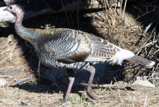
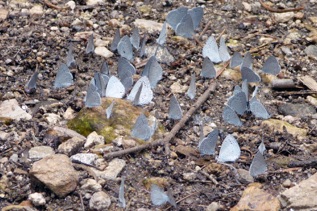
Spring azure butterflies (Celastrina ladon) and wild turkey (Meleagris gallopavo) in Santa Catalina Mountains
The Biomes of the Sky Islands
Ecologists categorize the world’s major ecosystems into “biomes,” classified by their distinctive vegetation and associated climatic conditions. In the past, biologists have described the biomes of the Santa Catalina Mountains in slightly different ways. While they have been in agreement about the overarching sense of turnover in plant species and community change with elevation, they have used somewhat different names for the various biomes. For example, ecologists have sometimes used the terms “encinal” or “lower encinal” for oak woodland, “open encinal” for oak-grassland, etc. But the overall concept and descriptions of these biomes have remained remarkably stable. Forrest Shreve, in his benchmark 1915 paper, categorized the slopes of the Catalinas into three broad zones based on the biogeographic origins of the predominant plants: desertscrub, encinal (dominated by Madrean species), and forest (dominated by Rocky Mountain species). Shreve’s idea was compelling, but it didn’t subdivide the biomes finely enough, nor does it work well on the fringes of the Sky Island Region where plant community affinities are not so clear-cut. In a detailed series of papers by Whittaker, Niering, Lowe, Moore, and Brusca, Shreve’s ideas were refined into the scheme below. The scheme presented here is basically that given in Niering and Lowe’s classic 1985 publication, and it is based on vegetation analyses of transects in the Catalinas established by the Arizona Sky Island Arthropod Project (see Moore et al. 2012), which recognized 8 biomes on the slopes of Arizona’s Sky Islands (two more would need to be added to include the Sky Islands of Sonora, Mexico (Thornscrub and Tropical Dry Forest). In Arizona, there is (from lowest to highest): Desertscrub, Desert Grassland, Oak-Grassland (also known as Oak Savanna), Oak Woodland, Pine-Oak Woodland, Chaparral, Pine Forest, and Mixed Conifer Forest. Not all of the Madrean Sky Islands are high enough to have all of these biomes, and many lack Pine Forest and/or Mixed Conifer Forest.
The higher biological communities of the Sky Islands have been isolated from one another for a very long time. Oak Woodlands in these mountain ranges have been isolated since end-Pleistocene warming drove woodland and forest species up in elevation and isolated them on the mountains, around 10,000 years ago. Pine Forests and Mixed Conifer Forests have been isolated for much longer. Research suggests that as the last Pleistocene ice age drew to a close ~14,000 years ago, southern Arizona biomes existed at elevations around 3000 feet lower than seen today. This means many of the Sky Islands were once fully connected by oak woodlands, although few, if any, were connected by pine forest. Thus, if global warming trends continue, these same biomes will gradually be pushed higher and higher up the mountains, until the uppermost biome, the Mixed Conifer Forest, is pushed off the top and disappears.
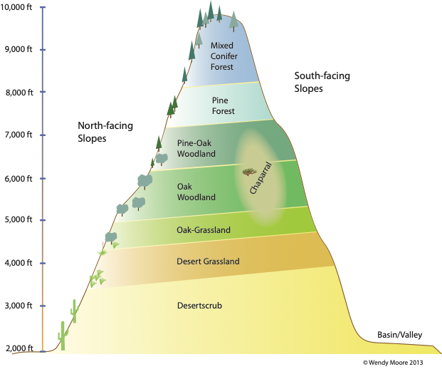
The 8 biomes found on Arizona’s Sky Island ranges
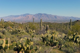
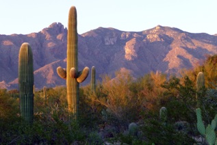
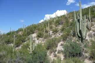
The Desertscrub Biome of Arizona’s Sky Island Region
North American desert biomes are divided into three types—cold-temperate (Great Basin Desert), warm-temperate (Mojave and Chihuahuan Deserts), and subtropical (Sonoran Desert). The last two are both found in the Sky Island Region. The Sonoran Desert is the lowest elevation desert in North America (although Death Valley, in the Mojave Desert, is the lowest point in North America at 282 feet below sea level), and it is the only subtropical desert in the Southwest. Sonoran Desertscrub vegetation is unique in the predominance of legume trees (e.g., palo verdes, mesquites, acacias, ironwood) and large, tall columnar cacti (e.g., saguaro, organpipe cactus, senita, cardón). On the lowest slopes of most of Arizona’s Sky Island ranges, a palo verde-mixed cactus community predominates, and this is the famous “saguaro-palo verde” forest that many people think of when they think of the Sonoran Desert.
In this habitat ocotillo, brittlebush, canyon ragweed, triangle-leaf bursage, whitethorn acacia, catclaw acacia, Engelmann prickly pear, fishhook barrel cactus, fishhook pincushion cactus, staghorn and jumping (chainfruit) cholla, and velvet mesquite grow profusely, along with the signature palo verde and saguaro. The Desertscrub biome on the southern flanks of the Santa Catalina Mountains is among the most biologically diverse habitats in that range. Only the savanna-like habitats (Desert Grassland and Oak-Grassland) have more species of plants. In the southern and easternmost parts of Arizona’s Sky Island Region (and in northern Sonora) many of the ranges are surrounded by Chihuahuan Desertscrub or Desert Grassland rather than by Sonoran Desertscrub, because of the higher elevation at the mountain base.
On the southern slopes of the Catalinas, Sonoran Desertscrub extends to around 3850 ft elevation, where it begins to transition into Grassland or Oak-Grassland. Desertscrub does not occur on the north side of the Catalinas because the lowest elevation there is ~4000 ft. However, on the northern slopes of the Catalinas between 4000 ft and 4750 ft grassland has been largely converted to mesquite scrubland by over a century of grazing and suppression of natural fires, giving the landscape a desert-like appearance. Here, some cold-tolerant desert species have invaded due to fire suppression and severe disturbances from livestock grazing in the grassland habitats.
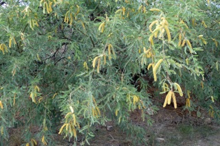
Riparian corridors in Desertscrub habitat, with either surface or subsurface water, are home to large, winter-deciduous, broadleaf trees that play a key role in the overall desert ecosystem. Common desert riparian trees are: Fremont cottonwood; Goodding, Bonpland, and desert willow; Arizona sycamore; velvet ash; and Arizona walnut. Adjacent and upslope from these wet corridors, and on the floodplains of rivers and washes, another unique vegetative community known as a “mesquite bosque” is often present—a mix of velvet mesquite, catclaw acacia, and several other plants that form a distinctive microphyllous lowland plant association. However, the great mesquite bosques that once grew along most Arizona desert drainageways, such as the Gila and Santa Cruz Rivers and their tributaries, are now largely gone due to over-harvesting for timber, firewood, building, and other uses that began when the mining, cattle, and the railroad industries arrived in the region.
Either Chihuahuan Desertscrub or Chihuahuan Grassland surrounds most of the eastern Sky Islands. But, most of the Chihuahuan Desert sits on the Mexican Plateau in north-central Mexico and adjacent United States (nearly 90 percent of the Chihuahuan Desert lies in Mexico). This is the southernmost North American desert, but because of its high elevation, it is warm-temperate, not tropical. The vegetative community of the Chihuahuan Desert is made up of a great diversity of woody shrubs, small succulent plants, and desert grasses. Although plant diversity is high (~3000 species, including ~315 cacti), there are no trees except in riparian corridors and only a few species of arborescent cacti. The Chihuahuan Desert first met and mingled with the Sonoran Desert in the Sky Island Region (by way of the North American Cordilleran Gap) only about 4000 years ago, as the final stages of North American desert formation took place.
Sonoran Desertscrub habitat & velvet mesquite found at the base of most of Arizona’s Sky Islands
The Desert Grassland Biome of Arizona’s Sky Island Region
North America’s grasslands cover huge areas from the Great Plains of central Canada south across the great Mexican Plateau almost to Mexico City, west to the Sonoran Desert of Arizona, Sonora, and the Baja California Peninsula. Although desert grasslands are difficult to define and classify precisely, which has engendered considerable debate and a plethora of names, there is no doubt they have a distinctive flora. The structure of the vegetation is a patchy mix of grasses, succulents, shrubs, and shrubby trees, with grasses visually dominating the landscape.
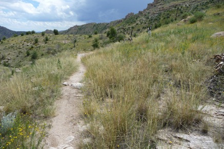
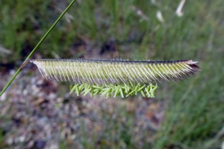
In the Sky Island Region, Desert Grassland (sometimes called “Semidesert Grassland”) is a relatively predictable mixture (a climax community) of native perennial and annual grasses, with scattered shrubs and succulents. This unique biome skirts the hills and mountain ranges of southwestern U.S. and northwestern Mexico. It reaches its northern limit in Arizona, New Mexico, and Texas, but ranges south into Mexico all the way to the state of Puebla. Being hotter and drier than North America’s Great Plains grassland, the Desert Grassland biome of the Southwest differs from it in sustaining a much lower primary production and overall biomass, and in being dominated by C4 grasses (rather than C3 grasses, which dominate the Great Plains grasslands). The period of peak growth for North America’s Desert Grassland coincides with the summer monsoon season (June-September), rather than the spring/fall growth cycle of temperate North American Great Plains grasslands.
Although the concept of Sonoran Vs. Chihuahuan Desert Grassland has not been well codified in the literature, these two grassland types are often referred to (Brusca & Moore 2013 and Moore et al. 2013 recognize them as distinct). Sonoran Desert Grassland is a warmer and lower-elevation biome, with biogeographic ties to the tropical flora of Sonora and Sinaloa; it is heavily dominated by C4 grasses. Chihuahuan Desert Grassland is a colder and higher-elevation biome, with biogeographic ties to the temperate flora of the Great Plains and the high-elevation plants of the Mexican Plateau; it has a broad mix of C4 and C3 grass species. These two grassland biomes mix and mingle in southeastern Arizona, where overlap occurs via the Cordilleran Gap. However, southeastern Arizona is, overall, high country compared to most of the Sonoran Desert, and as one moves west into the Lower Colorado River Subregion of the Sonoran Desert, and south to Sonora and Baja California, many endemic Sonoran Desert grasses make their appearance (e.g., Chloris brandegeei, Stipa speciosa, Bouteloua annua, Cenchrus palmeri, numerous species of threeawns, etc.). Similarly, as one moves south from the borderlands of New Mexico/Texas and Mexico, toward Mexico City, many cold-tolerant endemic Chihuahuan Desert grasses make their appearance (e.g. Bouteloua breviseta, Muhlenbergia majalcensis, etc.). Of course, some grasses are widespread and occur in both Sonoran and Chihuahuan Desert Grassland, such as big sacaton (Sporobolus wrightii), bush muhly (Muhlenbergia porteri), tabosa grass (Pleuraphis mutica), and many of the grama grasses (Bouteloua spp.).
In Arizona, Desert Grassland and Oak-Grassland occur between Desertscrub and Oak Woodland—roughly between 3800 ft and 5000 ft elevation. In the lower-elevation western region (e.g., Santa Catalina Mountains) Sonoran Desert Grassland predominates. The warm-temperate Chihuahuan Desert Grassland occurs in the eastern region (e.g. Pinaleño Mountains) and into Chihuahua, western Coahuila, and northeastern Sonora. On the Mexican Plateau, Chihuahuan Desert Grassland can be found south almost all the way to Mexico City. In the valleys of southeasternmost Arizona and adjacent New Mexico and Sonora, Chihuahuan Desert Grassland is the most widespread biome. Sulfur Springs Valley, Arizona, is a good place to see the inter-fingering of Sonoran and Chihuahuan Desertscrub, and Sonoran and Chihuahuan Desert Grassland, although much of the native grassland there has been destroyed or degraded by over a century of ranching practices, including the introduction of numerous exotic Old World grasses. South of the huge Sierra el Tigre complex in Sonora, grasslands are largely replaced by Foothills Thornscrub which surrounds most of the ranges all the way to the Sierra de Mazatán.
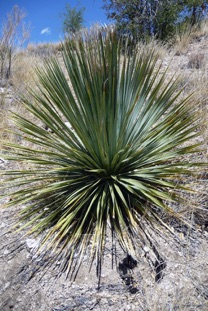
In addition to true grasses, Desert Grassland communities in Arizona commonly include beargrass (a relative of yuccas), mountain yucca, sotol, shindagger agave, wait-a-minute bush, silktassle bush, coral bean, and occasionally ocotillo, velvet mesquite, soaptree yucca, Emory oak, and desert broom (mainly in disturbed areas).
In grassland areas that have been heavily grazed or where fire has historically been suppressed (by livestock removing fine fuels, or by more active extinguishing of fires), woody desertscrub species that can withstand cooler elevations invade and flourish at the expense of grasses (e.g., velvet mesquite, catclaw acacia, graythorn, desert broom, Fendler buckbrush, fairy duster). Along the Control Road on the north side of the Catalinas, there is almost no grassland that hasn’t experienced some grazing over the past 150 years, and for this reason invasive woody desertscrub species are common on that grassy landscape. Cattle eat mesquite seedpods and then drop the seeds (in readymade fertilizer), spreading this plant as they graze in grasslands. In addition, the absence of periodic fire (due to ranching and land management practices) allows shindagger agave and soaptree yucca to flourish, and these also compete with native grasses. In these unnatural situations, especially when the water table has fallen or the soils are poor, mesquite is commonly stunted, and such disturbed/invaded areas are called “mesquite grassland” or “mesquite scrubland, or shrubland.” In undisturbed settings, periodic natural fires help maintain grasslands and prevent shrub invasion. But in areas of long-term fire suppression, which went along with ranching for most of the past century, native grasses declined and were replaced by mesquite shrubland. This transition from grasslands to shrublands, due to livestock grazing, fire control, and invasive species, has occurred throughout southeastern Arizona.

Sonoran Desert Grassland habitat & sotol (Dasylirion wheeleri)

Coral bean (Erythrina flabelliformis) & blue grama (Bouteloua gracilis), common in Arizona’s Desert Grassland
The Oak-Grassland Biome of Arizona’s Sky Island Region
The greatest diversity of oak species in the world is found in Mexico, where at least 125 species have been identified, and Oak-Grassland, Oak Woodland, and Oak Forest are some of the most common habitat types in the American Southwest below 6500 ft elevation. Oak-Grassland, sometimes called “oak savanna,” is found between lower-elevation (or drier) Desert Grassland and higher-elevation, more tree-dense Oak Woodland. Oak-Grassland differs from Oak Woodland in that it is more open in structure, with a higher percentage of grasses and herbaceous plants. In contrast, Oak Woodlands are stands of primarily oak, with far fewer ground shrubs and grass, and Oak Forest is a biome where the oaks are so dense and large that they form a canopy. These oak biomes are somewhat idealized constructs and are not so neatly distinct on the ground. In fact, they can grade into one another almost indistinguishably.
On Arizona’s Sky Islands, between 4000 and 5000 ft, depending primarily on latitude and slope aspect, Desert Grassland habitat transitions to Oak-Grassland. Some ecologists have regarded southwestern Oak-Grassland habitat as no more than an ecotone, or transitional area of overlap between two otherwise distinct habitats of Grassland and Oak Woodland. This is a fair argument, as there are no known species unique to the Oak-Grassland biome. However, this habitat forms a recognizable community on virtually every Madrean Sky Island, and it can exist even where lower-elevation Desert Grassland or higher elevation Oak Woodland are absent.
The main trees of Oak-Grassland in Arizona’s Sky Islands are Emory oak, Arizona white oak, Mexican blue oak, Arizona rosewood, and Arizona juniper. Border pinyon pine, hollyleaf buckthorn, beargrass, mountain yucca, bull grass, and golden-flower, Parry, and shindagger agaves can also be common in this biome. The chaparral plants pointleaf manzanita and madrone also straggle into Oak-Grassland habitat in some areas. In the Santa Rita, Chiricahua, Huachuca, Mule, and Dragoon Mountains of the border region, Toumey oak can be found in Oak-Grassland habitat, often extending up into the Pine Forest. South of the border, many new Mexican oak species begin to appear on the landscape.
In the Santa Catalinas, along the Mt. Lemmon Highway at around 4200 ft, rolling hillsides and canyons of Oak-Grassland dominate the landscape. The most abundant plants here are Emory oak, Arizona white oak, and five grasses—side-oats grama, cane beardgrass, Arizona panicgrass, invasive Lehmann lovegrass, and the elevationally wide-ranging bullgrass, as well as a dozen other less-common species. Other abundant plants of the Catalinas’ Oak-Grassland biome include pointleaf manzanita, shindagger agave, sotol, beargrass, and mountain yucca.

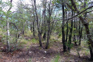
Oak Grassland (and Emory oak, Querqus emoryi) of Arizona’s Sky Island ranges
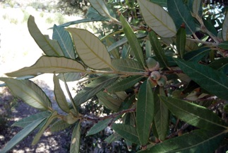
The Oak Woodland Biome of Arizona’s Sky Island Region
Oak Woodland is generally characterized by stands of oaks with junipers and occasional pinyon pines. It has far fewer ground shrubs and grass than Oak-Grassland habitat. In Arizona, Oak Woodland is best developed in the extreme southeastern corner of the state, but in northwestern Mexico it dominates much of the higher terrain of Sonora, Chihuahua, and Durango, and this biome reaches its maximum development in the Sierra Madre of Mexico. Some of the best-developed Oak Woodlands in Arizona are right on the border, between Nogales and the Pajarito Mountains (e.g., Walker Canyon), in the Huachuca Mountains, and on the high peaks of the Sierritas (e.g., Keystone Peak) 50 miles southwest of Tucson.
The term “woodland” is generally used to describe areas where individual tree canopies do not connect to form a complete canopy cover, as opposed to “forest,” which refers to areas where trees grow dense enough to form a complete canopy (e.g., pine forest). In some Arizona ranges, oak woodlands are so dense that thick canopies do form, such as on the western and southern slopes of the Huachuca Mountains, justifying calling those densely stocked oak habitats Oak Forest. Oak Forest occurs on many of Sonora’s Sky Islands, although many of them have been heavily thinned by local wood harvesters. In the Sky Island Region all of the oak communities (Oak-Grassland, Oak Woodland, Oak Forest) are sometimes referred to as “encinals.” Oak Woodland in the Catalinas and most other Arizona Sky Islands encompasses northern representatives of the widespread pine-oak and open oak woodland plant species of Mexico’s Sierra Madre Occidental; for this reason they are often called Madrean Oak Woodlands. On some of the Sky Islands, and in the northern Sierra Madre Occidental, extensive open woodlands of Emory oak occur, and this tree is probably the most abundant low-elevation oak in northern Sonora and southern Arizona. However, on the northernmost Sky Islands (e.g., the Pinal and Superstition Mountains), Madrean oaks are largely replaced by temperate oak species from the north.
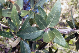
Oak Woodland (and silverleaf oak, Querqus hypoleucoides) of Arizona’s Sky Island ranges

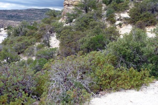
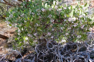
The Chaparral Biome of Arizona’s Sky Island Region
Chaparral is a vegetation type that typically occurs in Mediterranean climates, which are those with mild wet winters and hot dry summers. Chaparral plants tend to be evergreen sclerophyllous (with small, thick, leathery leaves) shrubs that have deep and wide-spreading root systems. They are well adapted to fire and reproduce from heat-scarified seeds that may be dormant in the soil for decades but are stimulated to grow by fire, or they resprout post-fire from enlarged root crowns, called burls. Chaparral is best developed on the west coast, from southwestern Oregon to California and northwestern Baja California. Pacific coast Chaparral is a highly diverse biome, containing well over 100 evergreen shrub species. Especially diverse are the genera Ceanothus (buckthorns) and Arctostaphylos (manzanitas). Over 40 species of Ceanothus, and nearly 60 species of Arctostaphylos, occur in California, about half of them being small-ranging endemics. In both genera, some of the species can resprout from root crowns after fire, while others rely on fire to stimulate seeds in the soil to sprout. Some species utilize both strategies (many, perhaps most of the Chaparral plants in the Sky Island region utilize both strategies). In Arizona’s Sky Island ranges, common fire-adapted shrubs such as pointleaf manzanita and silktassle bush resprout from root crowns within 12-18 months of a fire, while others such Fendler buckbrush sprout from fire scarified seeds in the soil.
Chaparral in the Sky Islands Region is not nearly as extensive or diverse as along the Pacific coast. Instead, it is patchy and usually referred to as Interior Chaparral. In Arizona, chaparral is dominated by border pinyon, scrub oak, silverleaf oak, madrone, alligator juniper, golden-flower agave, beargrass, bullgrass, and Pringle and pointleaf manzanitas. Border pinyon and sotol are also not uncommon, as well as Arizona white oak, Emory oak, Fendler buckbrush, mountain mahogany, silktassle bush, and mountain yucca.
Border pinyon (or piñon) is a Madrean species of pine whose range barely extends north of the border; it is common in the states of Sonora, Chihuahua, and Durango. It is the only 3-needled pinyon pine in Arizona and the only pinyon common south of the Mogollon Rim. In the Santa Catalinas, border pinyon is most often seen in Chaparral, but in other ranges of the Sky Island Region it can be common in Pine-Oak Woodland. Pinyon pine seeds (also called pinyon nuts) are a favored food of many animals, including black bears, porcupine, many small mammals, wild turkey, and many other birds, as well as humans.
Interior Chaparral habitat ranges from Nevada’s Virgin Mountains (on the border with Arizona), southward to northeastern Chihuahua and to the limestone mountains of Coahuila and Nuevo Leon. In the Catalinas it occurs on both sides of the range, but it is more extensively developed on the northern slopes where a greater variety of soil types enhance the overall plant diversity. Nearly all of the Chaparral communities along the Mt. Lemmon Highway burned in the 2003 Aspen Fire, and at this writing they are showing signs of strong recovery. Both pointleaf and Pringle manzanita can sprout from seeds in the soil that are stimulated by fire, but pointleaf also quickly resprouts from their root crowns (burls) after a fire. Burned Chaparral in Arizona’s Sky Islands will be seen resprouting just 12 months after being burned to the ground. Like pointleaf manzanita, Fendler buckbrush and Wright silktassle also quickly regrow after fires, both from seeds stored in the soil and from their root crowns.
On more exposed sites of the Madrean Sky Islands (mainly exposed south-facing slopes and ridges), where warmer and dryer conditions prevail, the same oaks found in oak woodlands may be present but of smaller stature, as are most of the other trees, such as alligator juniper and border pinyon (=Mexican pinyon) in Chaparral. Here, manzanita often grows in abundance, sometimes in great thickets punctuated by larger madrone trees, which can reach 40 ft in height. On limestone slopes (e.g., on the northern slopes of the Catalinas), mountain mahogany also occurs in Chaparral.
In Arizona’s Sky Islands, patches of Chaparral occur from about 5000 to 6800 ft, although manzanita plants can be found much higher, mixed among the pines. In fact, between 6000 and 7500 feet, burned conifer patches may be replaced by manzanita and other Chaparral plants, which, in these cases, provide a successional community before the pine forest returns (at still higher elevations, aspens and New Mexico locust fulfill this same successional niche, holding soil in place until new pines have reseeded and begun to sprout).
Chaparral (and pointleaf manzanita, Arctostaphylos pungens) of Arizona’s Sky Island ranges

The Pine-Oak Woodland Biome of Arizona’s Sky Island Region
The Pine-Oak Woodland biome occurs above Oak Woodland in Sky Island ranges, roughly between 5800 ft and 7500 ft. Especially in drier areas, mixed stands of pines and oaks can be found, including Arizona pine, Chihuahua pine, Apache pine, silverleaf oak, net-leaf oak, and Arizona white oak. Sometimes ponderosa pine will show up in Pine-Oak Woodland, especially on more northern Sky Islands, although the first appearance of ponderosa pine generally marks the transition into Pine Forest habitat. Also common is Fendler buckbrush, bull grass, alligator juniper, border pinyon, and California buckthorn. Mountain yucca, beargrass, and pointleaf manzanita may also make guest appearances in this community. South of the border, Durango pine (Pinus durangensis), Texas madrone (Arbutus xalapensis), and several other Mexican oaks also become common in this habitat.
Pine-Oak Woodland tends to have a dry woodland look to it, rather than the “conifer forest” feel of a pine-dominated forest. At lower elevations it may resemble Oak Woodland, because the oaks predominate, but as one moves up in elevation the pines increase in relative number. The pines stand high above the oaks and shrubs in this biome, their foliage usually providing solid shade. However, because of their size, the oak leaves are typically more conspicuous than the pine needles on the ground, unlike in a true Pine Forest, where the needles visually dominate the ground debris.
In southern Arizona, pines and oaks found in this biome are largely derived from the Sierra Madre Occidental, so this is sometimes called Madrean Pine-Oak Woodland, Mexican Pine-Oak Woodland, or Madrean Evergreen Woodland, although the farther north one travels in the Sky Island Region, the less significant the Madrean component becomes, as northern species increasingly dominate. The least “Madrean” of Arizona’s Sky Islands are the Pinal and Superstition Mountains.
Pine-Oak Woodland in the Catalina Mountains harbors about 50 common plant species, the most abundant being Chihuahua pine, Rocky Mountain ponderosa pine, Arizona pine, Douglas-fir, silverleaf oak, alligator juniper, Fendler buck brush, mountain yucca, and bullgrass.
Pine-Oak Woodland (and Arizona pine, Pinus arizonica) of Arizona’s Sky Island ranges
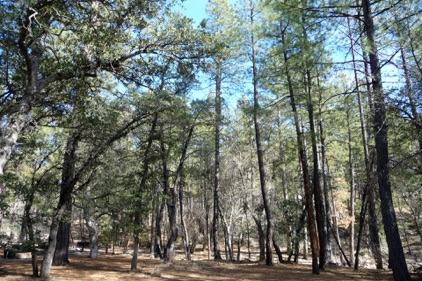
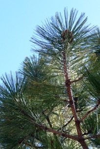
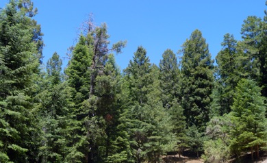
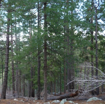
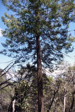
The Pine Forest Biome of Arizona’s Sky Island Region
Pine-Oak Woodland can transition quickly to Pine Forest in moister areas, such as on north-facing slopes. Between 7000 and 8000 ft, Arizona’s Sky Islands harbor large forests dominated by Arizona pine, ponderosa pine, and Douglas-fir. These conifer forests are actually some of the driest in all of North America, north of Mexico. On all but the northernmost Sky Islands, Pine Forest communities are home to some Madrean trees (e.g., Arizona pine, southwestern white pine, and silverleaf oak), especially at lower elevations. This low pine habitat has been called “Madrean montane conifer forest.” At higher elevations and higher latitudes, Rocky Mountain (Petran) plants dominate (e.g., white fir, Douglas-fir, and in moist areas Rocky Mountain maples). Patches of quaking aspen and New Mexico locust can be seen where the pine-dominated forest begins to give way to a Mixed Conifer (pine-fir-spruce) forest, or where fires or storms have downed the pines, in which case the aspen and locust act as successional plants. These northern-dominated pine forests have been called “Rocky Mountain montane forest.” The ponderosa pine and Douglas-fir species occurring in Arizona’s Sky Islands are distinct varieties, known as Rocky Mountain ponderosa (Pinus ponderosa var. scopulorum) and Rocky Mountain Douglas-fir (Pseudotsuga menziesii var. glauca). Ponderosa pine, a keystone species in the Pine Forest biome, is preferred by Mexican spotted owls for foraging, and Abert’s squirrel is dependent upon this species.
In the Catalinas, about four-dozen common species of plants occur in the Pine Forest biome. Most abundant are Arizona pine, ponderosa pine, Douglas-fir (not a true fir at all, hence the hyphenated name), southwestern white pine, silverleaf oak, and Fendler buckbrush. Less common are Gamble oak, Arizona white oak, bullgrass, Arizona madrone, alligator juniper, New Mexico locust, and quaking aspen (the last four being more common in cleared areas). In the Catalinas, Arizona pine begins to dominate the “tall pine” forests at around 7000 ft; at around 8000 ft ponderosa pine and Douglas-fir begin to take over as the dominant “tall pines,” and by 9000 ft Arizona pine has largely disappeared. Although white fir is occasionally seen in the higher pine forests of the Catalinas, this tree is more typical of the Mixed Conifer Forest and rarely occurs below 7400 ft.
Pine Forest (and Douglas-fir, Pseudotsuga menziesii var. glauca) of Arizona’s Sky Island ranges


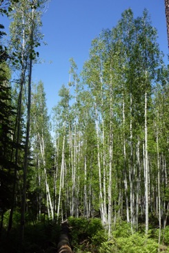
The Mixed Conifer Forest of Arizona’s Sky Island Region
Though cool, damp, and inviting, the Mixed Conifer Forest biome found near the tops of the highest Sky Islands has only about the same plant diversity as seen in Pine Forest. The predominant trees are ponderosa pine, Douglas-fir, southwestern white pine, white fir, and quaking aspen. White fir often has a bluish hue, causing it to stand out from the rest of the conifers in the forest. Rocky Mountain and bigtooth maple, Gamble oak, pineywoods geranium, mountain parsley, and bracken fern are found in moister areas. In areas cleared by fire or tree-fall, stands of quaking aspen and New Mexico locust thrive. In the Santa Catalinas, small, scattered corkbark firs grow at the highest elevations on Mt. Lemmon and Mt. Bigelow, mainly on the northern slopes. Spruces do not naturally occur in the Catalinas.
In the Pinaleños, the highest of all the Sky Islands, corkbark fir and Engelmann spruce are found in the Mixed Conifer Forest, and possibly blue spruce. Generally, firs and spruces don’t appear below 8000 ft south of the Mogollon Rim, and the lowest elevation at which we have seen corkbark fir trees in the Catalinas is just above 8000 ft (and almost only on north-facing slopes). These high forests are sometimes referred to as “Rocky Mountain subalpine forest.” The Pinaleños contain the most stacked life zones in the shortest vertical distance of any mountain in North America, and they support the only true spruce-fir forest in the Sky Islands (about 600 acres/243 ha that re inhabited by Engelmann spruce, white fir, and corkbark fir). The more southern Sky Islands, especially those in Mexico, commonly lack this biome altogether. The Mexican ranges close to the border, such as the Sierra de los Ajos, have mixed conifer patches restricted to the cooler and wetter north-facing slopes (in the Sierra de los Ajos, white fir, Douglas-fir, southwestern white pine, and Arizona pine co-occur at the highest elevations).
Stands of quaking aspen occur in open areas of Mixed Conifer Forest that have been burned, logged, or otherwise disturbed. Quaking aspen is probably the most wide-ranging tree in North America, occurring throughout Canada and the United States, although most of the U.S. populations (~75%) are now in New Mexico, and much of the remainder lies in the Mogollon Rim-White Mountain area. Quaking aspens are clonal, reproducing (and spreading) primarily by their roots, which send up shoots that grow into new trees. Although individual aspen trees typically live less than 100 years, the clonal stands made up of trees with the same genetic code can live thousands of years. One huge stand in Utah is estimated to be 80,000 years old! A variety of shrubs grow in the understory of quaking aspen stands, many of these also being closely associated with the early successional stages of the conifer forest (e.g., in Southern Arizona these include bracken fern, New Mexico raspberry, orange gooseberry, and others).
Mixed Conifer Forest (and quaking Aspen, Populus tremuloides) of Arizona’s Sky Island ranges